
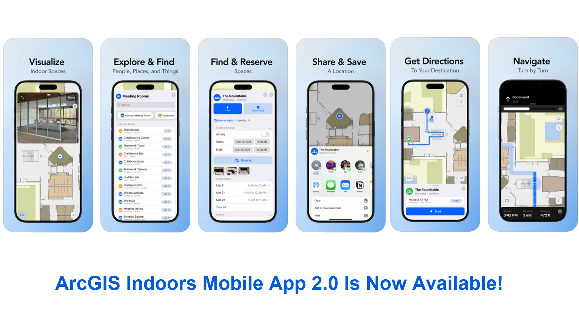
Esri is excited to announce the release of the newly redesigned mobile app, codenamed Indoors Mobile 2.0. The app has been developed from the ground up with an improved and intuitive user experience as well as brand new capabilities.
Get it today from the App Store and Google Play.
The first release of Indoors Mobile was over five years ago, bringing indoor maps in the palm of your hand when it matters the most – when you are on the go or out and about. Whether you are an employee heading for a meeting, a student dashing to the next class, facility worker locating an asset, or even a visitor arriving for the first time at a venue trying to find your way to an appointment, Indoors mobile app has you covered.
In addition to being able to view different floors of the building through indoor maps, Indoors Mobile enables you to:
- Find the nearest amenities like restrooms and safety assets like emergency exits and fire extinguishers.
- Get directions inside and between buildings and always know your location with the power of indoor positioning.
- Find and reserve workspaces – a space to work from when visiting a remote office or a meeting room located close to the people you collaborate with.
The just released Indoors Mobile 2.0 is built using ArcGIS Maps SDK (version 200.6) and it takes advantage of the latest development frameworks and patterns offered by iOS and Android platforms. This blog highlights some new and exciting capabilities and overall improvements.
Immersive 360-degree photo experience for better planning
Indoors Mobile now supports an immersive experience with the ability to configure 360-degree photos display of spaces. This enables facility occupants like employees or students to review the spaces they wish to use, before arriving or reserving, to ensure it meets their needs. Similarly, facility workers can view 360-degree photos before visiting a service location to assess the environment’s conditions and to better plan tools and equipment needed to efficiently carry out their tasks.
Learn more about adding 360-photos to your indoor map and read our blog on Building An Indoor GIS With Reality Capture.
Enhance your facilities experience with location photos
In addition to 360-degree photos, Indoors Mobile supports displaying photos for specific locations such as buildings, landmarks, or even a café’s menu. These images can be sourced from a URL, ensuring that updates to the photos are directly available without the need for users to download map updates.
Learn more about associating one or more photos with different locations and configuring them in the pop-up windows in your indoor map.
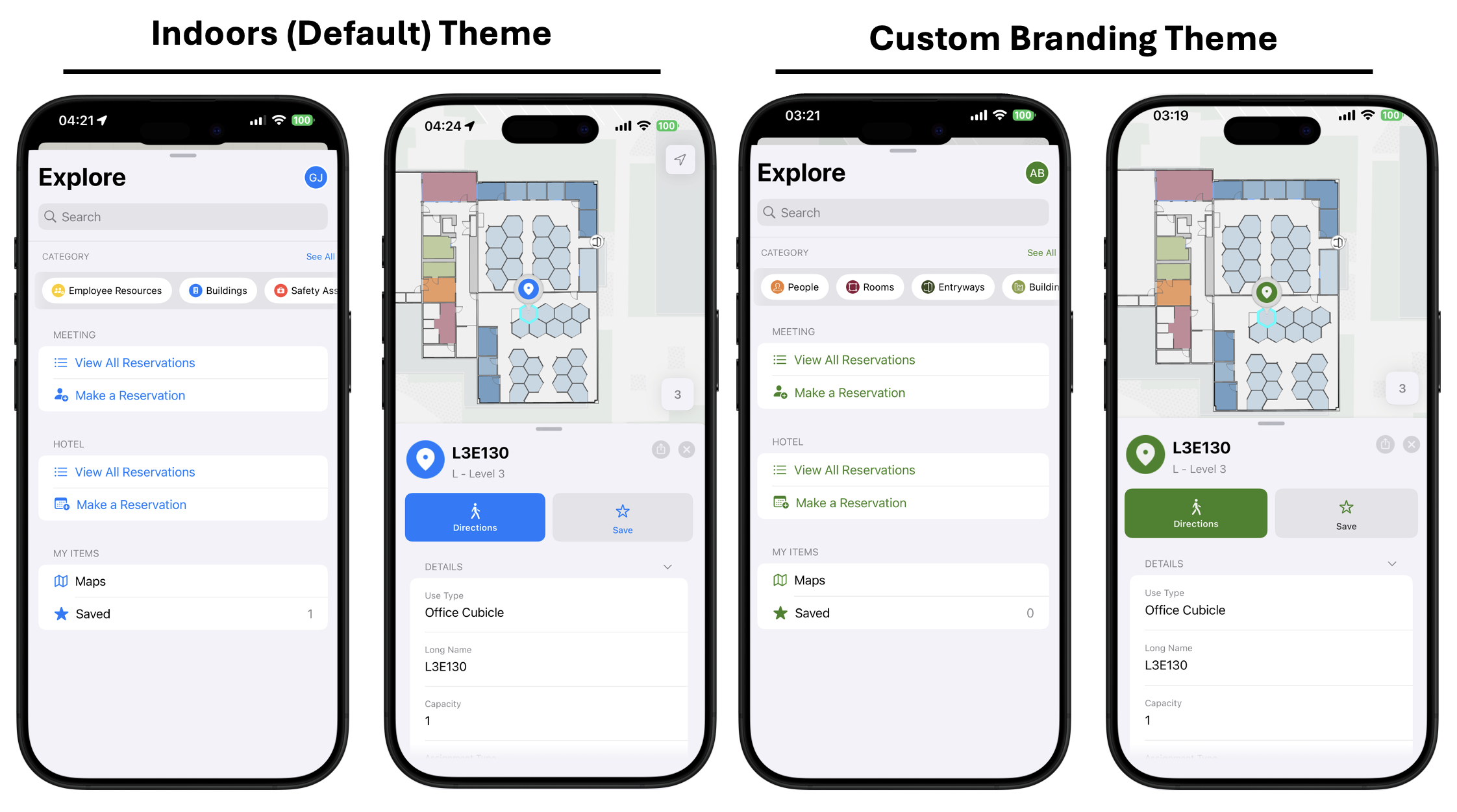
Personalize the app for your organization
You can now incorporate your own branding in Indoors Mobile. Specify a custom color for button text and background and add a logo for the splash screen to match the theme or brand colors of your organization to make the app look more familiar to your users. Configured branding colors are applied automatically when visitors or users with an account specify the URL to your ArcGIS organization.
Learn more about configuring custom branding colors.
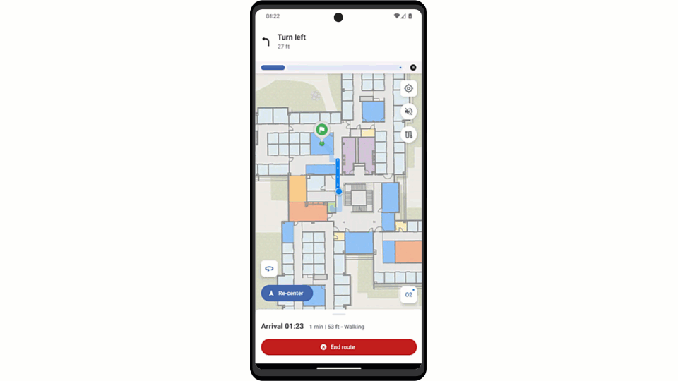
Automatic turn-by-turn navigation with audible instructions
Indoors Mobile now offers turn-by-turn navigation that progresses automatically and provides audible instructions as you proceed towards your chosen destination. This helps reduce the need to glance at the device screen and stay focused on the path. This update utilizes the latest enhancements made in ArcGIS IPS.
Learn more about setting up ArcGIS IPS to enable progressive navigation.
Other Notable Enhancements
Along with the new capabilities highlighted above, the Indoors mobile app 2.0 also includes:
- Support for dark mode – The theme of the app automatically matches the theme of your device if it is set to dark mode.
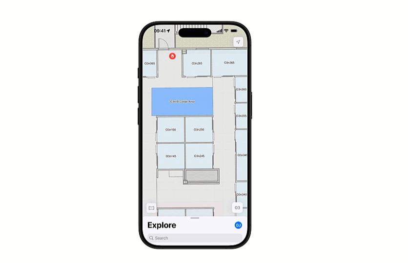
- Redesigned search and explore – The app provides an intuitive experience to search and explore people, places, and things in your indoor map.
- Improved workspace reservation – The redesigned experience makes booking office hotels and meeting rooms quick and easy.
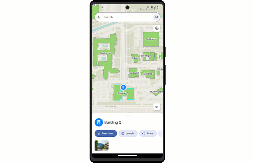
- Share a location – Share any location on the indoor map as a tiny URL link with others using your device’s default app of your choice.
- Smart launch – Create QR codes to help occupants and visitors to automatically download maps that directly open to a specified location, making it easier to get directions.
Learn more about getting started with Indoors Mobile and get it today from the App Store and Google Play. Join our Early Adopter Community to get early access to future updates and to help grow and improve the app.
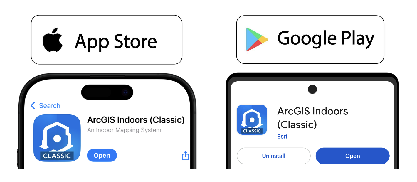
ArcGIS Indoors (Classic)
The first (previous) version of Indoors Mobile has been renamed to ArcGIS Indoors (Classic). All your existing mobile maps will automatically work with the new app. New capabilities will become available once the maps are updated based on the documentation for the respective features mentioned above.
ArcGIS Indoors (Classic) will remain available for iOS and Android, with documentation in the Mobile (Classic) tab. It can be used alongside the new and redesigned 2.0 app to help with transitioning.
Resources
Explore Indoor GIS resources to stay up-to-date on the latest information.